Boizenburg | |
|---|---|
 Town hall | |
 Flag  Coat of arms | |
Location of Boizenburg
within Ludwigslust-Parchim district
| |
 Location of Boizenburg | |
 Boizenburg  Boizenburg | |
| Coordinates: 53°22′N 10°43′E / 53.367°N 10.717°E / 53.367; 10.717 | |
| Country | Germany |
| State | Mecklenburg-Vorpommern |
| District | Ludwigslust-Parchim |
| Government | |
| • Mayor | Rico Reichelt (SPD) |
| Area | |
• Total | 47.43 km2 (18.31 sq mi) |
| Elevation | 15 m (49 ft) |
| Population (2024-12-31)[1] | |
• Total | 11,048 |
| • Density | 232.9/km2 (603.3/sq mi) |
| Time zone | UTC+01:00 (CET) |
| • Summer (DST) | UTC+02:00 (CEST) |
| Postal codes | 19258 |
| Dialling codes | 038847 |
| Vehicle registration | LWL, LUP |
| Website | www.boizenburg.de |

Boizenburg (German pronunciation: [ˈbɔʏtsn̩ˌbʊʁk] ) is a town in the Ludwigslust-Parchim district in Mecklenburg-Vorpommern, Germany. It is situated on the right bank of the Elbe, 53 kilometres (33 mi) west of Ludwigslust, 25 km (16 mi) northeast of Lüneburg and 50 km (31 mi) east of Hamburg. It is, via its district, a part of the Hamburg Metropolitan Region. Boizenburg's historical old town is located on the Boize, a tributary of the Elbe to which the town is connected by a harbour. With a well preserved old town, Boizenburg offers heritage baroque timberframe and brick architecture.
During the Cold War, Boizenburg was part of East Germany, being located only about 7 km (4.3 mi) east of the Inner German Border (Iron Curtain).
Etymology
The German name Boyceneburg was first documented in 1158. The written form changed to Boiceneburg (1171) and then Boizeneburg (1195). The old Low German name for the town and river (Boize) likely stems from the Slavic boj for war.
Boizenburg is, since 17 March 1939, officially called Boizenburg/Elbe to differentiate it from other settlements with similar names, primarily Boitzenburg in the Uckermark region.
Geography
The town has an area of 47.43 km2 (18.31 sq mi) and comprises 9 ortsteile: Bahlen, Bahlendorf, Gehrum, Gothmann, Heide, Metlitz, Schwartow, Streitheide, Vier.[2][3]
Boizenburg is situated on the Boize river, with the old town being located between the Old and New Boize with a former moat. To its north is mainland Mecklenburg while to its south lies the Elbe floodplain and, after the Sude canal, the Elbe itself.
The town borders Nostorf to the west, Schwanheide to the north-west, Gresse to the north, Neu Gülze and Teldau to the east, and Bleckede in the state of Lower Saxony to the south (mostly across the Elbe river). The municipality of Teldau has an exclave to Boizenburg's south, resulting in the town only sharing a land border of only around 600 m (2,000 ft) instead of 1.75 km (1.09 mi) with Bleckede.
Transport
Boizenburg lies on the Berlin-Hamburg railway and is serviced by the RE1 between Hamburg and Rostock via the Boizenburg (Elbe) station. The town is bypassed by the B5 to the north and the B195 federal road passes through the eastern part of the town, near the train station, from north to south. The A24 federal highway is located roughly 22 km (14 mi) north of Boizenburg.[2]
Climate
| Climate data for Boizenburg (1991–2020 normals) | |||||||||||||
|---|---|---|---|---|---|---|---|---|---|---|---|---|---|
| Month | Jan | Feb | Mar | Apr | May | Jun | Jul | Aug | Sep | Oct | Nov | Dec | Year |
| Mean daily maximum °C (°F) | 3.5 (38.3) |
4.8 (40.6) |
8.4 (47.1) |
14.3 (57.7) |
18.6 (65.5) |
21.6 (70.9) |
23.9 (75.0) |
23.7 (74.7) |
19.2 (66.6) |
13.5 (56.3) |
7.6 (45.7) |
4.3 (39.7) |
13.6 (56.5) |
| Daily mean °C (°F) | 1.3 (34.3) |
2.0 (35.6) |
4.5 (40.1) |
9.1 (48.4) |
13.2 (55.8) |
16.2 (61.2) |
18.4 (65.1) |
18.1 (64.6) |
14.3 (57.7) |
9.7 (49.5) |
5.1 (41.2) |
2.3 (36.1) |
9.5 (49.1) |
| Mean daily minimum °C (°F) | −1.0 (30.2) |
−0.6 (30.9) |
0.9 (33.6) |
4.2 (39.6) |
7.9 (46.2) |
11.0 (51.8) |
13.3 (55.9) |
13.3 (55.9) |
10.2 (50.4) |
6.4 (43.5) |
2.7 (36.9) |
0.1 (32.2) |
5.7 (42.3) |
| Average precipitation mm (inches) | 56.7 (2.23) |
44.4 (1.75) |
46.1 (1.81) |
36.7 (1.44) |
53.5 (2.11) |
62.8 (2.47) |
79.2 (3.12) |
67.4 (2.65) |
51.5 (2.03) |
52.7 (2.07) |
49.8 (1.96) |
57.9 (2.28) |
664.4 (26.16) |
| Average precipitation days (≥ 1.0 mm) | 17.3 | 15.3 | 15.2 | 11.9 | 13.7 | 13.9 | 15.8 | 14.9 | 13.7 | 15.3 | 16.2 | 18.1 | 180.3 |
| Average snowy days (≥ 1.0 cm) | 6.3 | 5.3 | 4.0 | 0.2 | 0 | 0 | 0 | 0 | 0 | 0 | 1.4 | 4.1 | 23.4 |
| Average relative humidity (%) | 88.3 | 84.5 | 79.7 | 71.9 | 72.1 | 72.9 | 72.5 | 73.9 | 79.4 | 85.7 | 89.7 | 90.0 | 80.4 |
| Mean monthly sunshine hours | 42.2 | 67.3 | 119.8 | 185.0 | 225.4 | 219.3 | 219.3 | 204.0 | 152.2 | 106.5 | 47.9 | 34.3 | 1,623.1 |
| Source: NOAA[4] | |||||||||||||
History
Boizenburg suffered during the Thirty Years' War, and its old castle was burnt down by Swedish troops in 1628. In 1709, the church and 160 or more medieval dwellings were incinerated by a fire. The Town Hall was rebuilt in 1712, and the layout of the town was redesigned by Prussian architects sent from Schwerin. They focused on incorporating efficiency of movement with fire-resistance, better sanitation, and public space.
During the Napoleonic Wars, French troops were quartered in Boizenburg in 1807. A battle was fought with the retreating French army near Boizenburg in 1813.
From 1815 to 1918, Boizenburg was part of the Grand Duchy of Mecklenburg-Schwerin. In 1826, a highway was built, connecting Hamburg, Berlin, and subsequently Boizenburg (Highway "B5"). In 1846, the railway between Berlin and Hamburg was constructed. Boizenburg was included with its own train station along this important route.
The shipbuilding yard Lemmsche founded in 1793 became highly industrialized in 1852 and produced many wooden and steel ships. The shipbuilders Thomsen & Co supported the German war effort during World War II. In 1973 the SED reactivated the shipbuilding facilities for the production of smaller inland ships for the USSR. After being privatized in 1989, the yard was declared bankrupt in 1997. Smaller, independent companies are active in the old shipyard.
The Boizenburg Tile Factory established by Hans Duensing in 1903, became Europe's largest tile manufacturer by 1937. After being re-established in 1991, it remains one of the town's main employers. Artistic impressions of the tile work produced in Boizenburg—particularly in the Art Nouveau style - can be found at the Erstes Deutsches Fliesen Museum.
Until 30 April 1945 a Nazi concentration camp was established in Boizenburg. The camp was a subcamp to the Neuengamme concentration camp.[5]
On 12 March 1953 a Royal Air Force Avro Lincoln heading to Berlin was shot down over Boizenburg by two Soviet Air Forces MiG-15 aircraft.[6]
During the communist East German era, residents of Boizenburg were kept under close scrutiny by the Stasi. Many deemed "politically untrustworthy" had their property confiscated during a state-sponsored terror campaign code-named Operation Vermin.
Politics
Boizenburg is, despite not being a part of it itself, the seat of the nearby Amt Boizenburg-Land.
City council
Boizenburg's city council regularly consists of 25 members but decreased to 21 members after the most recent 2024 Mecklenburg-Vorpommern local elections, held on 9 June 2024, because the Alternative for Germany (AfD) won five seats but only had one candidate, resulting in vacant seats and a decreasing council size. The 2024 city council election yielded the following results:[7]
| Party | Votes | Share | Seats | ||||
|---|---|---|---|---|---|---|---|
| % | +/- | Awarded | Filled | +/– | |||
| Christian Democratic Union of Germany (CDU) | 4,310 | 28.79 | 7 | 7 | |||
| Alternative for Germany (AfD) | 2,755 | 18.40 | New | 5 | 1 | ||
| Citizen for Boizenburg e. V. (BfB) | 2,643 | 17.66 | 4 | 4 | |||
| Social Democratic Party of Germany (SPD) | 2,587 | 17.28 | 4 | 4 | |||
| The Left | 1,737 | 11.60 | 3 | 3 | |||
| Home and Identity (HuI) | 506 | 3.38 | New | 1 | 1 | ||
| Ind. Christine Dyrba | 432 | 2.89 | New | 1 | 1 | ||
| Total | 14,970 | 100.0 | 25 | 21 | |||
| Valid votes | 14,970 | 95.74 | |||||
| Invalid/blank votes | 218 | 1.39 | |||||
| Total votes | 15,188 | 100.0 | |||||
| Turnout | 5,212 | 55.09 | |||||
| Eligible voters | 9,461 | ||||||
Mayor
Twin towns
Sights
One of the advantages of Boizenburg's isolation during the Cold War is the pristine natural landscape of the Elbe Valley region stretching to the north, south and east. Much of the architecture and infrastructure in the old city remained 'perfectly untouched' during the DDR regime. In addition to significant restoration projects, new installations such as the modern redesign of the harbor and the addition of a topiary garden have greatly added to the old town's charm.
 Old Moat on the Bollenberg
 Ship model along the Old Moat
 Boizenburg Harbour looking towards the Elbe and shipbuilding docks
 Topiary garden
 Topiary garden: water snail
 View of the East wing of the St. Marien Church
 Mausoleum in Boizenburg's Graveyard
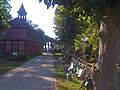 Path in Boizenburg's Graveyard


Notable people
- Georg Christian Benedict Ackermann (1763–1833), theologian and teacher
- Hermann Burmeister (1849–1935), jurist, 40 years (1879-1919) mayor of Boizenburg, since 1922 honorary citizen
- Leonhard Adelt (1881–1945), bookseller, writer and journalist
- Heinrich Laag (1892–1972), Evangelical theologian
- Rüdiger Beckhaus (born 1955), chemist
Notes
- Awarded:
 5, Filled: 1
 - Although HuI is a legally independent group, its personnel is nearly identical with that of The Homeland which partook in the last election under its old name National Democratic Party of Germany (NPD) where it won one seat (meaning a seat change of
 0 or a percentage change of
  1.79).
References
- Official German list of concentration camps Verzeichnis der Konzentrationslager und ihrer Außenkommandos (in German)
- "Bevölkerungsstand der Kreise und Gemeinden 2024" (XLS) (in German). Statistisches Amt Mecklenburg-Vorpommern.
- Boizenburg/Elbe, Stadt. "Daten und Fakten". Stadt Boizenburg/Elbe (in German). Retrieved 10 June 2026.
- Boizenburg/Elbe, Stadt (16 September 2024). "Hauptsatzung der Stadt Boizenburg/Elbe". Stadt Boizenburg/Elbe (in German). Retrieved 10 June 2026.
- "Boizenburg Climate Normals 1991–2020". National Oceanic and Atmospheric Administration. Archived from the original on 16 September 2023. Retrieved 16 September 2023.
- The camp is listed as No. 150 Boizenburg, Kreis Hagenow in the official German list.
- https://www.ndr.de/geschichte/schauplaetze/12-Maerz-1953-Abschuss-bei-Boizenburg,abschussboizenburg101.html
- "Ergebnis". votemanager.kdo.de. Retrieved 10 June 2026.
- NSCH. "Boizenburg: Als Mittler der Bürger Kurs halten | svz.de". svz (in German). Archived from the original on 1 October 2014. Retrieved 10 June 2026.
- "Rico Jakobeit gewinnt Stichwahl | SPD Boizenburg". spd-boizenburg.de (in German). Archived from the original on 11 February 2022. Retrieved 10 June 2026.
- ""Demokratie ist kein Selbstläufer" | Pro Peace". www.propeace.de (in German). Retrieved 10 June 2026.
- "Ergebnis". votemanager.kdo.de. Retrieved 10 June 2026.
- Boizenburg/Elbe, Stadt. "Partnerschaften". Stadt Boizenburg/Elbe (in German). Retrieved 10 June 2026.