Hlobyne
Глобине | |
|---|---|
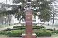
 Monument to the city's founder, Cossack Ivan Hloba | |
 Flag  Coat of arms | |
 Interactive map of Hlobyne | |
 Hlobyne  Hlobyne | |
| Coordinates: 49°23′25″N 33°15′01″E / 49.39028°N 33.25028°E / 49.39028; 33.25028 | |
| Country | |
| Oblast | Poltava Oblast |
| Raion | Kremenchuk Raion |
| Hromada | Hlobyne urban hromada |
| First mentioned | 1725 |
| Population (2022) | |
• Total | 8,955 |
| Postal code | 39000 |
| Area code | +380 5365 |
| Website | https://globynska-gromada.gov.ua/ |
Hlobyne (Ukrainian: Глобине, pronounced [ˈɦlɔbɪne] ; Russian: Глобино) is a city in Kremenchuk Raion, Poltava Oblast, Ukraine. It hosts the administration of Hlobyne urban hromada, one of the hromadas of Ukraine.[1] Population: 8,955 (2022 estimate).[2]
Geography
Hlobyne is located in the central part of Kremenchuk Raion, 37 km from the district center (Kremenchuk), 96 km from the regional center (Poltava).[3] The city is located on the Dnieper lowland, in the forest steppe natural zone, on the left bank of the Dnieper valley. The city is fed by a tributary of the Psel River. Chernozems dominate the territory of the Hlobyne.[4][5]
The climate of the Hlobyne is temperate continental. The average temperature in January is −3.7 °C, in July it is +21.4 °C, the amount of precipitation is 480–580 mm/year, which falls mainly in the summer as rain.[6]
History
.jpeg)
Hlobyne originally had the status of a town.[7]
It was a village in Poltava Governorate of the Russian Empire.[8]
During the Ukrainian War of Independence, from 1917 to 1920, it passed between various factions. Afterwards, it was administratively part of the Kremenchuk Governorate of Ukraine,[9][10] and after its dissolution of the Poltava Governorate of Ukraine.[11]
During World War II it was occupied by German troops since September 1941 until September 1943. A Nazi concentration camp was established in the buildings of the local sugar factory.[12]
In 1976, the urban-type settlement of Hlobyne received the status of a city.[8][13][14]
In January 1989 the population was 13 717 people.[15][14]
In January 2013 the population was 10 043 people.[16]
Until 18 July 2020, Hlobyne was the administrative center of Hlobyne Raion. The raion was abolished in July 2020 as part of the administrative reform of Ukraine, which reduced the number of raions of Poltava Oblast to four. The area of Hlobyne Raion was merged into Kremenchuk Raion.[17][18]
Demographics
As of the 2001 Ukrainian census, Hlobyne had a population of 12,801 inhabitants. The distribution of the population by ethnicity and native language according to the census data was as follows:[19][20]
Transport
Regional highways and a railway (Poltava-Oleksandriia) run through the city.[3][5]
Gallery
 Taras Shevchenko monument
 Cosmonauts Street in Hlobyne
 A street with private houses in Hlobyne


References
- "Глобинская громада" (in Russian). Портал об'єднаних громад України. Retrieved 2019-08-08.
- Чисельність наявного населення України на 1 січня 2022 [Number of Present Population of Ukraine, as of January 1, 2022] (PDF) (in Ukrainian and English). Kyiv: State Statistics Service of Ukraine. Archived (PDF) from the original on 4 July 2022.
- "Глобине | Кременчуцький район, Полтавська область". mista.ua (in Ukrainian). Retrieved 2025-07-06.
- "ПАСПОРТ ГЛОБИНСЬКОЇ МІСЬКОЇ ТЕРИТОРІАЛЬНОЇ ГРОМАДИ". Сайт громади globynska-gromada.gov.ua (in Ukrainian). Retrieved 2025-07-06.
- Булава Л. М. Природа та населення Полтавської області. Навчальний посібник. – Полтава: Полтавський обласний інститут післядипломної освіти педагогічних працівників ім. М.В. Остроградського, 2017. – 42 с. Retrieved 2025-07-05
- Заставний Ф. Д. Географія України. У 2-х кн. / Ред. M. П. Паpцeй. – Львів: Світ, 1994. – 472 с. Retrieved 2025-07-05
- Енциклопедія українознавства. Словникова частина (ЕУ-II). Vol. 1. 1993. pp. 386–390.
- "Історична довідка | Глобинська громада". Сайт громади globynska-gromada.gov.ua (in Ukrainian). Retrieved 2025-07-06.
- С. Хургін (1922). Адміністраційна Мапа Української Соц. Рад. Республіки (Map). 1:1,680,000 (in Ukrainian). Kharkiv: Народний комісаріат внутрішніх справ.
- С. Я. Хургин (1921). Карта Украинской Социалистической Советской Республики (Map). 1:1,680,000 (in Russian). Народный комиссариат внутренних дел.
- Административная карта Украины (Map). 1:1,050,000 (in Russian). Народный комиссариат внутренних дел. 1923.
- Концентрационные лагеря, образованные на территории СССР немецко-фашистскими захватчиками в 1941-1944 гг. Список составлен по материалам Чрезвычайной Государственной Комиссии (ЧГК) // газета "Судьба", июнь 1995. стр.3-6 Retrieved 2019-08-08
- Глобино // Советский энциклопедический словарь. редколл., гл. ред. А. М. Прохоров. 4-е изд. М., «Советская энциклопедия», 1986. стр.313 Retrieved 2019-08-08
- Глобино // Большой энциклопедический словарь (в 2-х тт.). / редколл., гл. ред. А. М. Прохоров. том 1. М., "Советская энциклопедия", 1991. стр.312 Retrieved 2019-08-08
- Всесоюзная перепись населения 1989 г. Численность городского населения союзных республик, их территориальных единиц, городских поселений и городских районов по полу Retrieved 2019-08-08
- "Чисельність наявного населення України на 1 січня 2013 року. Державна служба статистики України. Київ, 2013. стор.87" (PDF). Archived from the original (PDF) on 2013-09-21. Retrieved 2019-08-08.
- "Про утворення та ліквідацію районів. Постанова Верховної Ради України № 807-ІХ". Голос України (in Ukrainian). 2020-07-18. Retrieved 2020-10-03.
- "Нові райони: карти + склад" (in Ukrainian). Міністерство розвитку громад та територій України. Retrieved 2020-10-03.
- "Національний склад міст".
- "Рідні мови в об'єднаних територіальних громадах України".