Steinfeld | |
|---|---|
 Town centre | |
_COA.svg) Coat of arms | |
Location of Steinfeld
within Vechta district 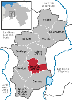 | |
 Location of Steinfeld | |
 Steinfeld  Steinfeld | |
| Coordinates: 52°36′N 8°13′E / 52.600°N 8.217°E / 52.600; 8.217 | |
| Country | Germany |
| State | Lower Saxony |
| District | Vechta |
| Subdivisions | 10 districts |
| Government | |
| • Mayor | Max Bernd Trumme (GFG) (Ind.) |
| Area | |
• Total | 60.05 km2 (23.19 sq mi) |
| Elevation | 47 m (154 ft) |
| Population (2024-12-31)[1] | |
• Total | 10,228 |
| • Density | 170.3/km2 (441.1/sq mi) |
| Time zone | UTC+01:00 (CET) |
| • Summer (DST) | UTC+02:00 (CEST) |
| Postal codes | 49439 |
| Dialling codes | 05492 |
| Vehicle registration | VEC |
| Website | www.steinfeld.de |
Steinfeld (German pronunciation: [ˈʃtaɪnˌfɛlt]) is a municipality in the district of Vechta, in Lower Saxony, Germany. It is situated approximately 16 km southwest of Vechta, and 40 km northeast of Osnabrück.
People
- Theo Schönhöft (1932–1976), German footballer
- Paul Schockemöhle (born 1945), German horse show jumper
- Andreas Bergmann (born 1959), German football coach and player
- Jürgen Krogmann (born 1963), German politician (SPD)